Note: this dataset description is metadata (data about data) which describes the actual dataset in accordance with the ANZLIC (Australia New Zealand Land Information Council) Core Metadata Guidelines Version 2 (February 2001)
ANZLIC unique identifier: ANZCW1003100029
Title: Wastewater artificial wetlands listed as important wetlands in Australia - point locations
Custodian: IndexGeo Pty Ltd
Jurisdiction: Australia
"A Directory of Important Wetlands in Australia Database" provided at Environment Australia classifies and describes certain wetlands that are of national significance. One category is "Wastewater Wetlands".
This dataset lists the point locations for that category of wetlands. A few wetlands are excluded because their waste water component was minor.
The actual spatial data is made available in various ways: a structured xml file with sites and site details, a simple a comma-separated values (CSV) file, and as a web mapping service.
Note: This service is under development.
- Only GIF images.
- No co-ordinate transformation, i.e. just geographic.
- WATER Maps
- Geographic extent name:
- Australia excluding external territories - AUS
Note: The format for each Geographic extent name is: Name - Identifier - Category - Jurisdiction (as appropriate)
Geographic bounding box:
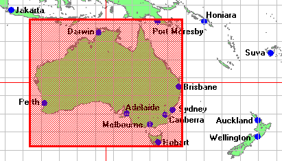
The bounding box encloses the maximum extents of the dataset. There may be voids or gaps within the bounding box, depending on the defined coverage of the dataset. Outer bounding rectangle as Latitude/Longitude coordinates based on the WGS84 datum (expressed as both Degrees Minutes Seconds and as decimal Degrees):
- North bounding latitude: 9 00 00.0 S (-9)
- South bounding latitude: 44 00 00.0 S (-44)
- East bounding longitude: 154 00 00.0 E (154)
- West bounding longitude: 112 00 00.0 E (112)
Distributor transfer options:
OnLine resource:
Linkage: http://www.indexgeo.com.au/cgi-bin/wms-location?request=GetMap&styles=default&layers=wastewet&bbox=130,-40,180,-35&SRS=EPSG:4326&TRANSPARENT=TRUE&width=738&height=369&format=image/gif&version=1.1Protocol:
httpApplication profile:
ogc:WMS-1.1.0-http-get-mapName:
IndexGeo: Wastewater artificial wetlands - point locationsDescription:
A web mapping service showing these locations.Function:
OnFunctCd:
downloadOnLine resource:
Linkage: http://www.indexgeo.com.au/data/wastewet/ANZCW1003100029.tar.gzProtocol:
httpName:
IndexGeo: Wastewater artificial wetlands - point locationsDescription:
The full dataset as a gzipped tar archive (ANZCW1003100029.tar.gz) including the xml file, the csv files, licence, and the dataset description.Function:
OnFunctCd:
downloadOnLine resource:
Linkage: http://www.indexgeo.com.au/cgi-bin/wms-location?request=GetCapabilities&service=WMSProtocol:
httpApplication profile:
ogc:WMS-1.1.0-http-get-capabilitiesName:
WMS Capabilities: IndexGeo Point Location MapserverDescription:
The Web Map Server capabilities description file.Function:
OnFunctCd:
informationOnLine resource:
Linkage: http://www.indexgeo.com.au/ec/pub/crossley/dataset/ANZCW1003100029.htmlProtocol:
httpApplication profile:
anzlic:metadata:anzmeta-1.3Name:
ANZLIC metadata: Wastewater artificial wetlands listed as important wetlands in Australia - point locationsDescription:
The full dataset description of this layer of the web mapping service.Function:
OnFunctCd:
information
Lineage:
The online database was consulted "A Directory of Important Wetlands in Australia Database" (http://www.ea.gov.au/water/wetlands/database/) and a search conducted for wetlands category "C6: wastewater treatment; sewage farms, settling ponds, oxidation basins". The reports for each entry were consulted to glean summary details (identifier, name, location).
The initial datafile was prepared on 2003-01-02 and verified on 2003-04-17.
Positional accuracy:
Not documented.
Attribute accuracy:
Not documented.
Logical consistency:
Not documented.
Completeness:
Each wetland of classification C6 is listed, but only if the entry is substantially a wastewater wetland. Thus three major wetlands were excluded because the waste water component was only a small part of a large flood-plain. So 5 out of the total 8 sites are listed.
Included:
- ACT011 - Jerrabomberra Wetlands
- VIC074 - Lindenow Wildlife Sanctuary
- SA069 - Murray Bridge Army Training Area Wetlands
- NSW055 - Wakool-Tullakool Evaporation Basins
- VIC121 - Werribee-Avalon Area
Excluded:
- QLD146 - Herbert River Floodplain
- QLD157 - Port Of Cairns and Trinity Inlet
- QLD161 - Tully River - Murray River Floodplains
The mapserver is available at: http://www.indexgeo.com.au/cgi-bin/wms-location
This is a test metadata record using an extended ANZMETA DTD to add the onLineSrc/linkage element (and its supporting elements borrowed from ISO 19115) to enable online links, directly from metadata to data (and services) and vice versa.
See explanation of how this discover-and-get capability is implemented - http://www.indexgeo.net/zap/onlink/
This dataset description complies with ANZLIC Core Metadata Guidelines Version 2 (February 2001) and XML DTD ANZMETA Resource 1.1 which extends ANZMETA 1.3 (metadata validation date: 2003-04-21)
| Eco Companion Australasia |
| Dataset description |
| Eco Companion home | browse | search | new |